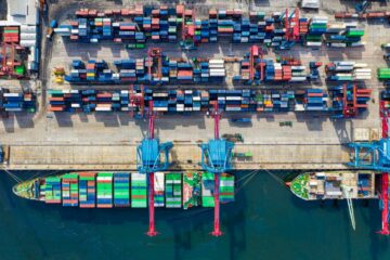
Maintaining a sustainable supply chain can seem like a daunting task, especially if you’re an FMCG company needing to communicate with suppliers, traders, growers and farmers. Even more so if you also have financial institutions breathing down your neck demanding you show positive results. And this past year hasn’t made the idea of managing a sustainable supply chain easier.
SourceDay, a supply chain management tool, said that whilst historically they found an average of 36% of line items would change over the lifecycle of a PO, in response to COVID-19, that average has jumped up to 61% of line items changing. This rapid increase in change can have a dramatic effect on the reliability of supply chain management as there are far more emails and notifications to acknowledge and deal with when updating your ERP. So, if your supply chain is harder to manage from a basic product number and variation perspective, surely monitoring the wider sustainability of your increasingly varied supply chain is even harder? Well, we don’t think so.
Whether you’re a farmer or FMCG, it is every person and company’s responsibility to ensure our supply chains are sustainable and therefore resilient. And thankfully there are tools and technologies to help make this easier and more transparent than ever before.
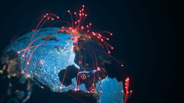
Why satellite data is important
With supply chains undergoing their biggest transformation since globalising decades ago, the ability to monitor what is going on from above is imperative. Satellites are able to offer an unbiased constant and consistent data stream on how crops and plantations are changing in near real-time. And satellites don’t only take pictures – they measure a huge array of variants such as CO2 levels, water surface temperature changes, and humidity. If you were to rely solely on optical imagery – and some monitoring services do – it would result in gaps of data that could span hours, days or weeks where vision has been obscured due to uncontrollable circumstances such as heavy cloud cover. That’s not exactly uncommon in rainforests.
Focusing on the monitoring of deforestation, radar sensors, which are available on certain satellites, are essential to monitoring forest cover changes as forested and non-forested areas have different radar signatures.
Where AI comes in
With so much data being gathered by satellites it can seem challenging to understand which data you should use to monitor and how you can turn that data into actionable insights. No human is capable of analysing that much data in a useful timescale, which is where machine learning algorithms come into play. Using A.I., we can analyse past and present data to identify which changes in forest cover, for example, should be labelled as likely to lead or be due to commodity production. As you can imagine, the more data the A.I. is able to absorb the better the alert system. And the better the alert system the faster and more effectively companies can address deforestation in their supply chains.
How does this help supply chains?
Satellite data is only one part of the puzzle. It can give unbiased data on forest change, but it cannot offer information on the ground and potential explanations for decreased forest cover. It also cannot stop deforestation in its tracks. That’s why satellite data must also be combined with on the ground information, such as anonymous surveys with locals, workers and farmers.
Once you know your information is reliable, it should be the responsibility of every person, company and organisation involved in the supply chain to act on it. And acting doesn’t necessarily mean stopping working with the potential “bad actor”. Various factors are at play when it comes to farmers and growers causing deforestation with poverty playing a major part. If you stop working with that farmer, you do not stop the poverty causing the deforestation, you merely hand over responsibility to the next company that pays for their produce.
Data from satellite monitoring should be used to start conversations, to stop deforestation through education and support – not by ignoring the problem and hoping it will go away if you don’t fund it. Companies must look at how they can help farmers learn how to farm in a sustainable way if we are to ever reach our global goal of 0% deforestation. And it’s up to everyone in the supply chain to take on that responsibility together.
About the Author
Arjen Vrielink – Satelligence
After graduating from Wageningen University in 2001, Arjen Vrielink started his career as a radar remote sensing specialist at SarVision. Six years ago he decided to look around and worked in various positions in the remote sensing and IT sector, including: technical consultant at an eLearning company, GIS analyst at a noise consultancy firm, product owner of an online geo-platform and optical remote sensing analyst at a water quality consulting company. In 2016 he joined Satelligence, a remote sensing company providing risk and performance services for natural capital, as co-owner / director to put his gained experience into practice.
- 2016
- AI
- algorithms
- analyst
- around
- Biggest
- breathing
- capital
- Career
- change
- Cloud
- co2
- commodity
- Companies
- company
- consultant
- consulting
- conversations
- COVID-19
- crops
- data
- deal
- deforestation
- Director
- Education
- farm
- farmers
- financial
- Financial institutions
- Firm
- fmcg
- fund
- Global
- growers
- hoping
- How
- How To
- HTTPS
- huge
- idea
- identify
- Including
- Increase
- information
- insights
- institutions
- involved
- IT
- lead
- LEARN
- learning
- Line
- machine learning
- major
- management
- measure
- monitoring
- Near
- Noise
- offer
- online
- owner
- performance
- perspective
- Poverty
- present
- Product
- Production
- puzzle
- quality
- radar
- real-time
- response
- Results
- Risk
- satellite
- satellites
- sensors
- Services
- SIX
- So
- start
- started
- suppliers
- supply
- supply chain
- supply chain management
- Supply chains
- support
- Surface
- Sustainability
- sustainable
- system
- Technical
- Technologies
- Traders
- Transformation
- university
- vision
- Water
- What is
- workers
- year
- years
- zero