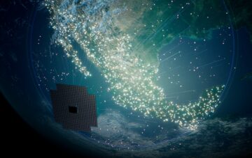
Radio-frequency data collected by HawkEye 360 satellites can be used to locate GPS interference hotspots
ST. LOUIS — The proliferation of electronic devices designed to interfere with Global Positioning System signals is a problem for the Pentagon and for many industries that depend on GPS, as disruptions affect every aspect of operations.
One of the challenges is identifying the precise location and source of interference, said Rob Rainhart, chief operating officer of HawkEye 360, a geospatial analytics company that uses satellites to track ships, vehicles or any devices that emit radio frequency signals.
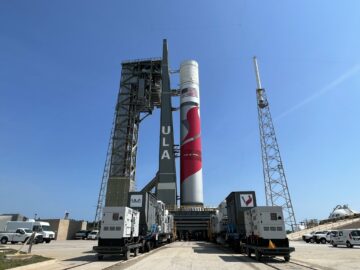
HawkEye 360 is one of several remote sensing satellite operators demonstrating their technologies at the 2021 GEOINT Symposium this week.
Rainhart said radio-frequency data collected by satellites can help to locate GNSS interference hotspots. GNSS is short for global navigation satellite system, or any satellite constellation that provides positioning, navigation, and timing (PNT) service.
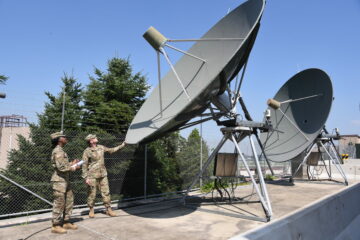
The company’s satellites, equipped with software-defined radios, fly in clusters of three: one in front, another behind and a third that oscillates back and forth. Three clusters are currently in orbit.
Rainhart said HawkEye 360 has briefed government and commercial customers concerned about the impact of GPS disruptions on how they could apply RF data analytics to spot interference.
The company has three clusters of satellites in orbit today and plans to launch more, which will “enable a much more fine-tuned interference monitoring toolkit,” he said.
“We’ve participated in some trials with foreign partners, looking at GNSS interference,” he said. “There’s a lot of interest in the problem from customers across the globe.”
DoD seeks proposals for detection of GNSS disruption
The Defense Innovation Unit (DIU), a Pentagon organization that works with commercial companies, wants to take advantage of the growing availability of data from space and other sources to geolocate GPS interference.
A DIU solicitation in August asked for proposals on “situational awareness for intentional disruption of GNSS users.” DoD is especially interested in “persistent, large-area coverage of falsified GNSS emitters that result in localized spoofing phenomenology.”
GPS signals can be denied through electronic jamming attacks. GPS users can also be attacked with falsified PNT data, a technique known as spoofing.
“The entire world is dependent on GNSS-based systems, yet the GPS architecture and its users are vulnerable to denial and manipulation by adversarial actors,” said DIU.
Nick Estep, DIU program manager, said the solicitation closed Aug. 23 and many proposals were received.
The goal is to experiment with commercially available data sources, both space-based and terrestrial, Estep told SpaceNews.
“There’s a whole commercial sector that plays within this domain and we’re certainly intrigued to tap into that,” he said.
An example is the Automatic Identification System (AIS) — an onboard navigation safety device that transmits and monitors the location vessels at sea in real time. “That’s a commercial commodity out there that is available and actually has been used in some circumstances to characterize intentional GNSS disruptions and spoofing,” said Estep.
“We’re not looking for a traditional program of record,” he said. “We want to leverage all these data sets and analytics that are already being used in a commercial setting or a commercial marketplace, and use this to complement the government capabilities.”
DUI is agnostic on which type of data or sensors are used. “There could be terrestrial information that informs GNSS spoofing or disruptions or it could be space based,” Estep said.
Many vendors from the space and data analytics sectors have responded to DIU’s solicitation, he said. DIU will select multiple companies this fall to make a pitch directly to military customers.
“Vendors that are successful past phase two have the opportunity to engage in executive prototypes with DIU, work with coders in a collaborative manner.”
A notable challenge for vendors is to show how they analyze data and draw conclusions from it, such as whether GPS interference is being perpetrated intentionally or if it’s accidental, said Estep.
“There’s different types of effects, and categories of disruption, and part of the challenge that our vendors will have to do is to be able to characterize the effect and show us the confidence they have in what they’re seeing,” Estep said. “And to show us you know how you came to that conclusion.”
Source: https://spacenews.com/space-data-used-to-detect-sources-of-gps-disruptions/
- 2021
- ADvantage
- All
- analytics
- architecture
- Attacks
- AUGUST
- availability
- challenge
- chief
- Chief Operating Officer
- closed
- collaborative
- commercial
- commodity
- Companies
- company
- confidence
- Customers
- data
- Data Analytics
- Defense
- Detection
- Devices
- Disruption
- DoD
- equipped
- executive
- experiment
- Global
- Government
- gps
- Growing
- How
- HTTPS
- Identification
- Impact
- industries
- information
- Innovation
- interest
- IT
- launch
- Leverage
- location
- Manipulation
- marketplace
- Military
- monitoring
- Navigation
- Officer
- operating
- Operations
- Opportunity
- organization
- Other
- partners
- pentagon
- Program
- Radio
- Safety
- satellite
- satellite constellation
- satellites
- SEA
- Sectors
- sensors
- setting
- ships
- Short
- Space
- Spot
- successful
- system
- Systems
- Tap
- Technologies
- time
- track
- us
- users
- Vehicles
- vendors
- Vulnerable
- week
- within
- Work
- works
- world